What will logging look like in Canada in five, 10 or even 15 years? It’s an interesting and important question to ask ourselves as technology development continues its exponential pace.
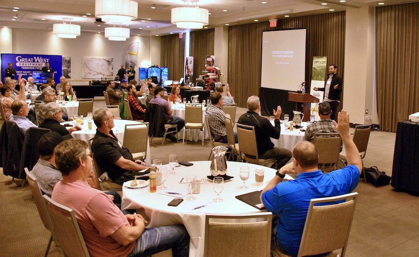
Canadian Forest Industries’ inaugural in-person OptiLog Forestry Tech Forum, held last week in Kelowna, gave the stage to forestry stakeholders who are not only asking that question, but, in most cases, developing solutions for the future.
Speakers touched on the future of drone technology, simulators, commercial thinning, winch assisting, and satellite and GIS solutions for forestry. Here’s a snapshot of what they covered.
Droning on
The morning kicked off with an overview of drones in forestry. Michael Wilcox with FYBR Solutions began by looking at where drones started and ended with thoughts on what’s next for forestry companies when it comes to aerial tools.
According to Wilcox, millions of drones are sold worldwide annually, and the number is growing rapidly. Most drones used in the forest sector are solely employed for reconnaissance, and the majority have a simple camera system to provide an eye in the sky.
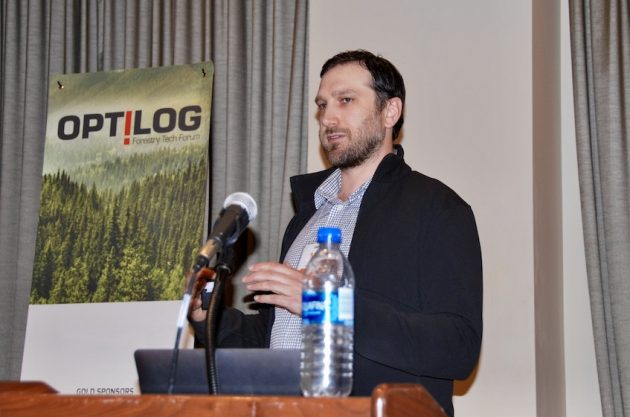
Mike Wilcox is the co-founder and president of FYBR Solutions. Photo: Annex Business Media.
More sophisticated drone systems are equipped to provide lidar or photogrammetry data. Last year, drone company DJI released a plug-and-play lidar system that is easy to use and covers a large forest area, making this data far more accessible to forestry companies.
Looking to the future, Wilcox said he expects to see both much larger drones, and much smaller drones and both to be fully automated with remote application.
Swedish company AirForestry’s harvester drone is one such example. CEO Elle Gelin joined us virtually to talk about their high-capacity drone that is being designed to support a light-weight harvester to remotely log and transport full trees. The harvester is flown directly to a tree, attaches to the top of the tree and uses gravity to delimb it, then saws it off and carries it to the nearest road.
The entire system is designed in order to minimize ground disturbance and to provide operators with a comfortable environment to remotely operate the drones. Watch a video of the system here.
Gelin said the drone recently completed liftoff outdoors and they are expecting to begin flight trials soon.
Harvesting BC
FPInnovations’ researcher Mihai Pavel spoke next on the planning and application of commercial thinning (CT) in B.C. In theory, commercial thinning can help end midterm fibre shortage sooner, increase long-term sustained yield of B.C.’s forests, and produce a better distribution of stands by age class.
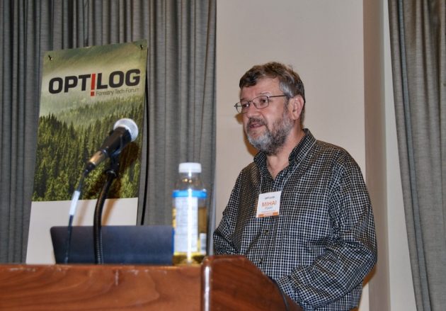
Mihai Pavel is a fibre supply researcher with FPInnovations. Photo: Annex Business Media.
Yet, there are unique challenges in B.C. and they vary by region. One common challenge is finding and retaining skilled harvester operators. Another is the cost of introducing harvesters and forwarders, which can be expensive machines compared to feller bunchers, skidders and processors.
“We need to develop cost and productivity [studies] region by region to factor in the different environments,” Pavel said.
Earlier this year, FPInnovations released an operational manual for CT in B.C. to share best practices for its application in the province.
Ponsse’s operator trainer Jussi Jurvanen is well versed in the challenges of operating a harvester and spoke on how simulators can assist contractors to improve operational efficiencies, as well as narrow in on potential operator candidates.
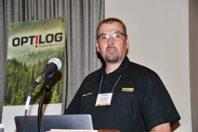
Jussi Jurvanen is an operator trainer and simulator training specialist with Ponsse. Photo: Annex Business Media.
Simulators provide a repeat environment to trial various working methods. Ponsse’s program tracks movement of the machine and the boom to analyse what system worked and what can be tweaked for a faster or more productive operator performance. The goal is to reduce unnecessary movements and to find the right balance between working quickly and working correctly.
It’s not easy to change routines because they make things easier at work, Jurvanen said, but we need to be a bit critical in order to understand how to save time and therefore money.
Going steeper
Dale Ewers, owner of DC Equipment and the Falcon Forestry Equipment brand, spoke next on the company’s decade of experience developing and using winch assist for logging operations.
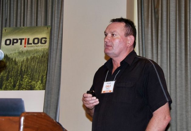
Dale Ewers is the owner of DC Equipment. Photo: Annex Business Media.
Ewers is both a logging contractor and equipment manufacturer, based in New Zealand. He said their equipment is designed with the goal of reducing their own employee rate of injuries. Since 2003, the company has seen a nearly 50 per cent drop in annual incidents.
Their Falcon winch system allows for fully mechanized harvesting on steep, challenging slopes, in any logging environment, and can support nearly all equipment types and payloads.
Looking to the future, DC Equipment is introducing a felling carriage, as well as an unmanned harvester that can be tethered. Both would remove operators from the felling environment entirely. The goal, Ewers said, is “zero harm.”
The company is also exploring the development of fully electric forestry machines.
Satellites and GIS
Paul Fantin, a forest program manager for First Resource Management Group’s SkyForest, introduced their newest harvest tracking solution that processes satellite data or any other data available to provide near-real-time harvest tracking on multiple harvest sites.
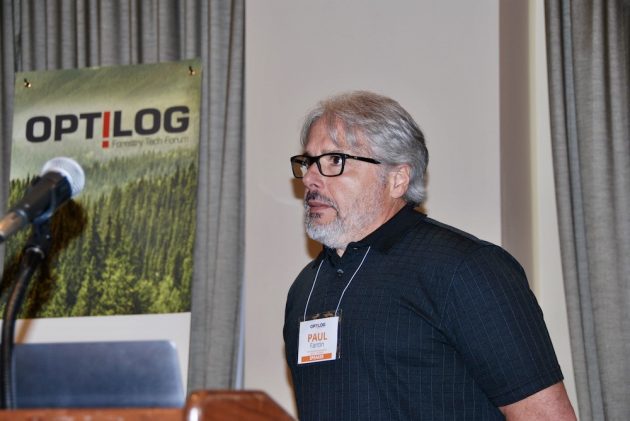
Paul Fantin is a forest program manager with First Resource Management Group / SkyForest. Photo: Annex Business Media.
The product is scalable and uses machine learning to continually improve its results. “We can correct the algorithm and run the whole block again,” Fantin said. They can provide a range of operational information from stems per hectare, to long-term operations optimization modelling.
Esri Canada’s Nathan Enge wrapped up the forum with a look at what GIS can offer the forest industry today and what’s to come.
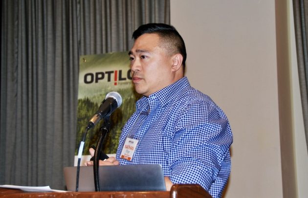
Nathan Enge is a senior technical solutions specialist with Esri Canada. Photo: Annex Business Media.
Currently, it’s possible to bring high-resolution maps into the field, track yourself, collect data and take pictures and video, all without cell service. This can also be done on a wearable, hands-free device. The information collected can then be shared on user-friendly dashboards, with certain info available to certain stakeholders according to what they need access to.
Workforce management is a likely next stage of GIS for forestry companies, Enge said. Companies can get location and status updates from remote employees and systemize workflows while ensuring each task is properly documented.
GIS and drone technology are also likely to integrate. The GIS could be used in drone mission software, and imagery could be uploaded into various products and used within GIS products immediately.
Thank you to our sponsors Ponsse, Great West Equipment, and Top Down Enterprises for making this event possible.
Stay tuned to OptiLogForum.com for notice of future events.